Real-time and historical water level data is available for many locations along the ICW. Boaters are advised to consult this data to gain additional knowledge to assist them in assessing CW channel depths and bridge clearances.
I have
Florida
Indian River Lagoon
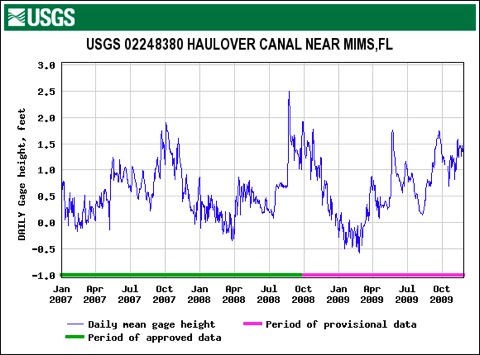
Haulover Canal Historical Data; Jan 07- Nov 09
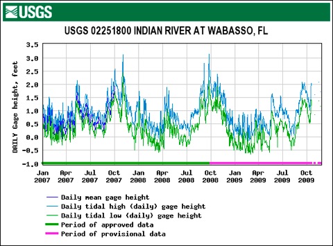
Wabasso Historical Data; Jan 07- Nov 09
Real-time Water Level Gage Readings
STM: 869.1
Location: Allenhurst Bridge, Haulover Canal
Gage: USGS 02248380
STM: 943.2
Location: Indian R at Wabasso Bridge
Gage: USGS 02251800
NOAA Tide Prediction Data
STM: 943
Location: Wabasso
Data: NOAA Tide Predictions
STM:
Location: Vero Beach
Data: NOAA Tide Predictions
News Articles Regarding Water Levels
- NOAA news release, 8 Sep 09, cites abnormally high water levels along the E coast due to Gulf Stream changes.
- Bay Journal article, Oct 09, on higher water levels along Atlantic coast.
Updated: 1 Dec 2009