ICW Information by ICW Statute Mile Marker
STM 0 to 100
Forward to STM 101-200
Updated: 12 October 2018
Hydrographs in this Section:
North Landing R @ Chesapeake & Ablemarle Canal
Latitude: 36.717778° N, Longitude: 76.100556° W,
https://water.weather.gov/ahps2/hydrograph.php?wfo=akq&gage=cacv2
North Landing R Near Creeds; Near Pungo Bridge
Latitude: 36.618110° N, Longitude: 76.046302° W,
https://water.weather.gov/ahps2/hydrograph.php?wfo=akq&gage=nlrv2
STM: 0
Nav. Marker / Location: R36, Hospital Point
Note: Start of the ICW
STM: 2.5
Single Bascule Bridge: Norfolk & Portsmouth Belt Line RR
Note: Normally open
STM: 2.7
Fixed Bridge: Jordan
Note: Vertical Clearance: > 90'
Transit reports, SV Onward:
Date | Time | HB N | HB S | EEH | Tide | Fenders | Comment |
23-Oct-16 | 0900 | >>65.75 |
TM: 3.5
Lift Bridge; Norfolk Southern RR
Note: Normally open
STM: 5.8
Double Bascule Bridge; Gilmerton
Note: Normally opens on demand
STM: 7.1
Fixed Bridge / Double Bascule; Interstate 64
Note: Vertical clearance: >65'. While listed as having a 65' vertical clearance, Onward's 65.75' air draft (to top of VHF antenna) has always experienced several feet of additional clearance. Planing is underway to replace this bridge (Oct 2016)
Transit reports, SV Onward:
Date | Time | HB N | HB S | EEH | Tide | Fenders | Comment |
23-Oct-16 | 1000 | >>65.75 |
STM: 7.2
Nav. Marker / Location: Junction with Dismal Swamp alternative route.
Note: For Dismal Canal Route, useful contacts to check on the latest canal conditions
- Corps of Engineers Great Bridge Lock in Chesapeake, Virginia; 757-547-3311
- Dismal Swamp Canal Welcome Center; 252-771-8333
STM: 8.8
Fixed Bridge; Dominion Blvd.
Note: The double bascule bridge has been replaced by a fixed bridge with >> 65' clearance.
Transit reports, SV Onward:
Date | Time | HB N | HB S | EEH | Tide | Fenders | Comment |
23-Oct-16 | 1200 | NHB | NHB | >65.75 | NTA | ||
STM: 11.5
Nav. Marker / Location: Great Bridge Lock
Note: The S wall (starboard southbound) has a rubber wall with rubber bumpers and no fenders are needed. The N wall requires fenders. The lock opens at 0:25 after the hour to load S-bound traffic. It opens the S gate at about 0:10 before the hour to coordinate with the opening of the Atlantic Intracoastal Bridge on the hour.
Closest Hydrograph to Great Bridge Lock:
North Landing R @ Chesapeake & Ablemarle Canal
https://water.weather.gov/ahps2/hydrograph.php?wfo=akq&gage=cacv2
STM: 12.1
Double Bascule Bridge; Atlantic Intracostal / Great Bridge
Note: Opens on the hour in coordination with Great Bridge Lock.
STM: 12.9
Fixed Bridge; Highway (Rt 168) Bypass
Transit reports, SV Onward:
Date | Time | HB N | HB S | EEH | Tide | Fenders | Comment |
23-Oct-16 | 1200 | NHB | NHB | >65.75 | NTA |
STM: 13.8
Single Bascule; Norfolk Southern RR
Note: Normally open
STM: 15.2
Single-Pivot Swing Bridge; Centerville Turnpike
Note:
STM: 20.2
Double-Pivot Swing Bridge; North Landing
Note:
STM: 28.7
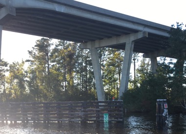
Fixed Bridge; Pungo Ferry
Closest Hydrograph to Pungo Ferry Bridge: North Landing R Near Creeds
https://water.weather.gov/ahps2/hydrograph.php?wfo=akq&gage=nlrv2
Transit reports, SV Onward:
Date | Time | HB N | HB S | EEH | Tide | Fenders | Comment |
23-Oct-16 | 1415 | 64.25 | 64.25 | ~64.25 | NTA |
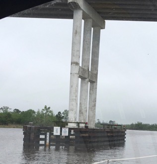
Pungo Ferry Bridge 23 Oct 16
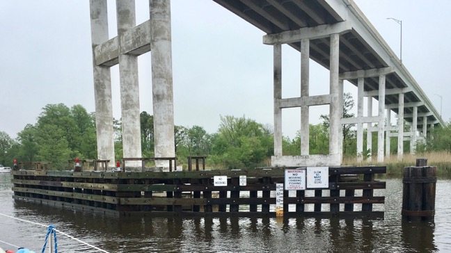
Pungo Ferry Bridge 23 Oct 16
STM 34.0
Nav. Marker / Location: VA-NC Border
STM: 50.1
Fixed Bridge; Coinjock
Transit reports, SV Onward:
Date | Time | HB N | HB S | EEH | Tide | Fenders | Comment |
23-Oct-16 | 1645 | 65.0 | 65.0 | ~64.75 | NTA |
Coinjock Bridge 23 Oct 16
STM: 65.0
Nav. Marker / Location: Albemarle Sound N entrance
Vessel Reporting: Onward
Date: May 2018
Report: Shoaling on the W side of the channel experienced in 2010 is no longer a problem SV Onward made transits in Oct 2017 and May 2018 without incident.
STM: 81
Nav. Marker / Location: Entrance to Alligator River at Long Point Shoal
Vessel Reporting: Onward
Date: Oct 2009; May 2010; Oct 2010
Report: Follow the markers for a safe passage and not the "magenta line" on older charts which show a jog in the channel S of long shoal point.
STM: 84.2
Single-Pivot Swing Bridge; Alligator River
Note: Perhaps the best bridge on the ICW in terms of boater-friendly / cooperative bridge tenders. Planning is underway (Oct 2016) to replace the bridge with a fixed bridge.
Forward to STM 101-200