ICW Information by ICW Statute Mile Marker
STM 901 to 1000
Back to STM 801 - 900
Forward to STM 1001-1100
Latest Update: 29 October 2018
Note: Cruisers can check real-time water levels in the Indian River Lagoon
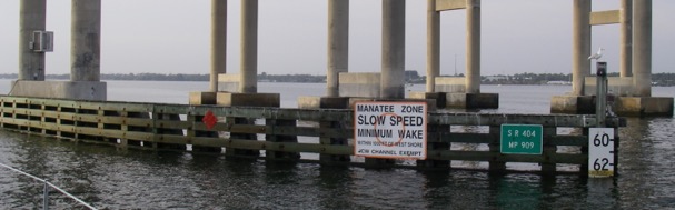
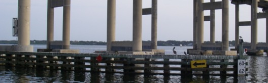
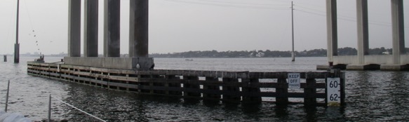
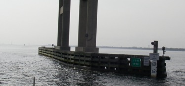
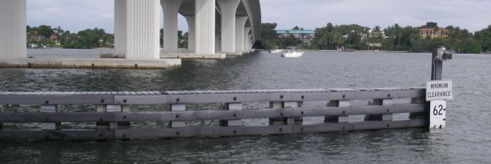
STM: 909.0
Fixed Bridge: Palm Shores
Transit reports by SV Onward:
Date | Time | HB N | HB S | EEH | Tide | Fenders | Comment |
24-Nov-09 | 0900 | 63.1 | 63.1 | ~64.75 | NTA | WL @ below middle of 4th FB | ~1' of VHF hit beams |
16-Nov-14 | 0910 | 64.5 | 64.5 | ~64.75 | NTA | ~1' of VHF hit beams. Lights hang below bridge ~0.5' | |
1-Nov-16 | 1330 | 64.1 | 64.1 | ~64.5 | NTA | WL @ just below top of 4th FB | |
Palm Shores Br. N
Palm Shores Br. S
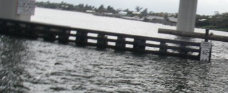
STM: ~914.0 Anchorage E of Dragon Point. A good anchorage with 14- 20' lies just to the E of the Dragon Point peninsula. Stay close to the DM G1 at the tip to avoid the shoal building out from the E end of the bridge.
STM: 914.4
Fixed Bridge: Eau Gallie
Transit reports by SV Onward:
Date
Time
HB N
HB S
EEH
Tide
Fenders
Comment
24-Nov-09
1000
63.1
63.1
65.5
NTA
WL at middle of 4th FB
~0.25' of VHF hit S beam of S span
16-Nov-14
64.75
64.75
64.75+
NTA
WL @ middle of 4th FB
0.5 to 1.0' of VHF hit beams; center lights protrude below beam with small wire loops
1-Nov-16
64.0
64.0
64.5
NTA
WL just below 4th FB
~1.25' of VHF hit beams
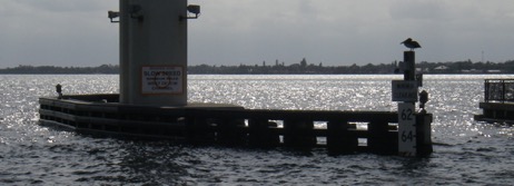
Eau Gallie Br. N

Eau Gallie Br. S
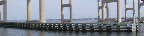
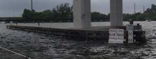
STM: 918.2
Fixed Bridge: Melbourne Causeway
Transit reports by SV Onward:
24-Nov-09 | 1100 | 63.5 | 63.5 | 65.0 | NTA | WL @ bottom of 4th FB | ~0.75' of VHF hit beams |
16-Nov-14 | 1020 | 64.5 | 64.5 | 65.75 | NTA | WL midway between bottom of 4th FB & top of 5th | VHF cleared beams. Hanging center lights; N wire loop to E; S wire loop to W. |
1-Nov-16 | 63.9 | 64.1 | 65 | NTA | WL @ bottom of 4th FB | ~0.75' of VHF hit beams |
Melbourne Causeway Br. N
Melbourne Causeway Br. S
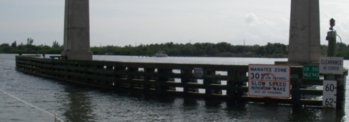
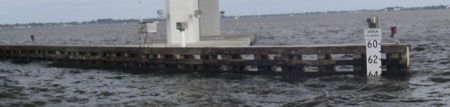
STM: 943.2
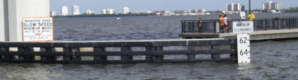
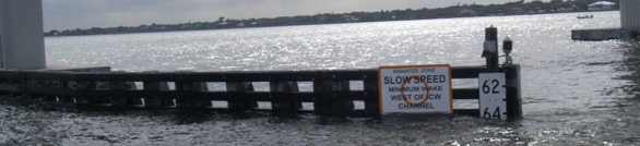
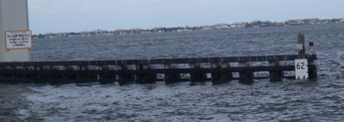
Fixed Bridge: Wabasso
Hydrographic gage on Indian River at Wabasso
Note: bridge clearance here is affected by tide and by wind conditions. Check hydrographic gage data for current water level.
Transit reports by SV Onward:
Date | Time | HB N | HB S | EEH | Tide | Fenders | Comment |
24-Nov-09 | 1400 | 63.0 | 63.0 | 64.75 | WL @ bottom of 4th FB | ~1' of VHF hit beams | |
2-Nov-16 | 0945 | 63.0 | 63.0 | 64.75 | 0.4' @ Wabasso Indian R | WL @ bottom of 4th FB | ~1' of VHF hit beams |
Wabasso Br. N
Wabasso Br. S
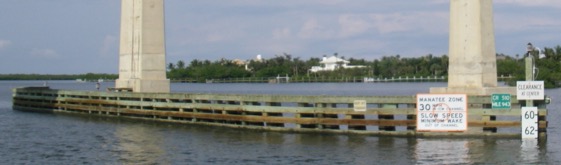
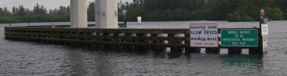
STM: 951.7
Fixed Bridge: Vero Beach
Transit reports by SV Onward:
Date | Time | HB N | HB S | EEH | Tide | Fenders | Comment |
6-Dec-09 | 0815 | 64.25 | 64.25 | >65.75 | 0.0 | WL @ top of 4th FB | VHF clear |
10-Nov-16 | 0700 | NHB | 63.75 | ~65.50 | 2.0 Eb @ Ft Pierce Inlet | WL just below middle of 3rd FB | Slight VHF tip contact with beam |
Vero Beach Bridge N
Vero Beach Bridge S
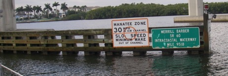
STM: 953.2
Fixed Bridge: 17th Street
Vessel Reporting: Onward
Date: 6 Dec 09
Report: Time 0830; Tide 0.0': Height boards: 65' Fender boards: water level at bottom of 4th board. VHF antenna interfered with the bridge by 3-4" (Min. Height = ~65.0').
Transit reports by SV Onward:
Date | Time | HB N | HB S | EEH | Tide | Fenders | Comment |
6-Dec-09 | 0830 | 65.0 | 65.0 | ~65.25 | Low | WL @ bottom of 4th FB | ~0.5' VHF hit beam |
10-Nov-16 | 0710 | 63.0 | 63.0 | 64.5 | 2.0 Eb @ Ft Pierce Inlet | WL just below middle of 3rd FB | ~1.25' VHF contact with beam |
17th Street Bridge N
17th Street Bridge S
Hydrographic Gage Indian River near Ft Pierce Inlet
STM: 963.8
Fixed Bridge: Ft. Pierce S.
Transit reports by SV Onward:
Date | Time | HB N | HB S | EEH | Tide | Fenders | Comment |
6-Dec-09 | 1200 | 64.0 | 64.0 | ~65.0 | 3.2' @ Ft Pierce Inlet | WL @ ~ just above top of 4th FB | ~0.75' of VHF hit beam |
10-Nov-16 | 0845 | 64.0 | 64.0 | >65.75 | 0.8 Eb @ Ft Pierce Inlet | WL @/just below top of 4th FB | VHF Clear |
Ft. Pierce S. Bridge S
STM: 981.4
Fixed Bridge: Jensen Beach Causeway
Transit reports by SV Onward:
Date | Time | HB N | HB S | EEH | Tide | Fenders | Comment |
6-Dec-09 | 1200 | 66.0 | 66.0 | >65.75 | 1.2 @ Ft. Pierce Inlet | WL @ bottom of 3rd FB | VHF clear |
10-Nov-16 | 1045 | 66.25 | 66.25 | ~65.5' | 0.7 Eb @ Jensen Beach | WL at top of 4th | ~0.25' of VHF hit beam w side of channel |
Note: SV Onward has consistently found this bridge to have better clearances than its neighbors N & S.
Jensen Beach Causeway Bridge N
Jensen Beach Causeway Bridge S
Hydrographic Gage St Lucie River near Steele Point
STM: 984.9
Fixed Bridge: Ernest Lyons
Transit reports by SV Onward:
Date | Time | HB N | HB S | EEH | Tide | Fenders | Comment |
6-Dec-09 | 1300 | 64.5 | 64.25 | ~63.75 | 1.3' @ Ft. Pierce Inlet | WL @ bottom of 3rd FB | VHF antenna bent in half, ~1.5' hit beam. The tricolor/anchor light was knocked over but the wind transducer cleared. |
10-Nov-16 | 1115 | 65.0 | 65.2 | ~65.0 | 0.3 Eb @ Sewall Pt | WL @ top of 4th FB | >0.75' of VHF hit beam |
Note: SV Onward has consistently found this bridge to be lower than its neighbors N & S.
Ernest Lyons Bridge N
Ernest Lyons Bridge S
STM: 987.8
Nav. Marker / Location: St. Lucie Inlet Crossroads: Shoaling
Vessel Reporting: Onward
Date: 6 Dec 09
Report: Onward turned W up the St. Lucie R after passing S of R204 until lined up with the centerline of the channel defined by 2, 3 and 2A, 3A. Time: 1330. Tide: High. Onward (6.2’ draft) saw a minimum of 7.4’ along the centerline of the channel about 1/3 way between 2, 3 and 2A, 3A.
Date: 10 Nov 16
Report: Onward turned W up the St. Lucie R after passing S of R204 until lined S of the the centerline of the channel defined by 2, 3 and 2A, 3A. Time: 1130. Tide: Low Onward (6.2’ draft) saw a minimum of 5.8’ just E of 3. A momentary sand or silt wave, no effect on boat motion.
STM: St. Lucie River NW of STM 987
Fixed Bridge:: Ocean Blvd / A1A
Transit reports by SV Onward:
Bridge | Date | Time | HB N | HB S | EEH | Tide | Fenders | Comment |
St. Lucie River Ocean Blvd A1A | 6-Dec-09 | 1330 | 64.0 | 64.0 | ~65.25 | Low | WL @ bottom of 3rd FB | ~0.5' of VHF hit beam |
| St. Lucie River Ocean Blvd A1A | 10-Nov-16 | 1205 | 64.0 | 64.0 | ~65.25 | 0.3' FL @ Sewall Pt | WL at top of 4th | ~0.5' of VHF hit beam |
Note: SV Onward has had to wait at this bridge for low tide to make some previous passages.
Ocean Blvd / A1A Bridge S
Ocean Blvd / A1A Bridge N
STM: St. Lucie River NW of STM 987
Fixed Bridge: NW Federal Highway / Rt. 1
Transit reports by SV Onward:
Date | Time | HB N | HB S | EEH | Tide | Fenders | Comment |
6-Dec-09 | 1400 | 65.5 | 64.1 | ~65.25 | ~Low | WL @ bottom of 3rd FB | ~0.5' of VHF hit beam |
NW Federal Highway / Rt. 1 Bridge E
NW Federal Highway / Rt. 1 Bridge W
Back to STM 801 - 900 Forward to STM 1001-1100
STM:
Nav. Marker / Location: